Special List 395: SLAM Winter Book Fair, Featured Items 21 featured items, with full-color illustrations
Bookseller Catalogs
Special List 395: SLAM Winter Book Fair, Featured Items 21 featured items, with full-color illustrations
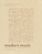
Catalogue 91 - Modern Music: 20th Century Part II 269 items featuring the works of interesting and influential composers active mainly from the second half of the 20th century to date. Including autograph manuscripts, first & early editions, books, and iconography.
Horticulture List #924 Horticulture List #924 (September 2024) contains a descriptive listing of 32 horticulture and gardening titles. Highlights include: Honore's Agenda de Sante, Paris 1777; Liger's Oeconomie Generale de la Campagne, Amsterdam 1701; Maddock's Florist's Directory, London 1792; and Seguier's Bibliotheca Botanica, The Hague 1740.
How to request a print version: If you would like a print version of this catalogue, please contact us at: Woodburn Books, ABAA, ILAB P.O. Box 398 Hopewell, NJ 08525 (609) 466-0522 info@woodburnbooks.com
Books About Music Nearly 1000 scholarly books relating to music including biographies & critical studies of composers & musicians, music history & criticism, musical instruments, opera & dance, reference works, bibliographies, catalogues, &c.
E-list #26 Big Little Books, archives, uncorrected galleys, a Buddhist text leaf written on tree bark, Confederate currency, political buttons, medallions, ribbons . . .
Firsts London Virtual Fair November 2020 - 19th & 20th Century Travel & More…
Firsts London Virtual Fair November 2020 - 19th & 20th Century Travel & More… Prints, ephemera, books & maps to voyage with while we are staying close to home...
Special List 394: Firsts Online, London’s Rare Book Fair Highlights
By Richard C. Ramer, Old & Rare BooksSpecial List 394: Firsts Online, London’s Rare Book Fair Highlights 20 Highlights from Firsts Online, London's Rare Book Fair, with full-color illustrations


